Halifax: August 27, 1912 <<< >>> Victoria: October 17, 1912
| Today's Statistics: | Travelling from Princeton, British Columbia to Ashcroft, British Columbia | |||
| Distance: 210 km | Driving Hours: 4.5 h | Fuel: 53 l | Weather: Sunny | Temperature: Min. 2 Max. 16 |
After leaving Princeton in the morning, the Reo travelled through ranch country to get to Merritt in the Nicola valley. The route is quiet and scenic with many small lakes alongside the road. Cattle and horses graze on the rolling hills.
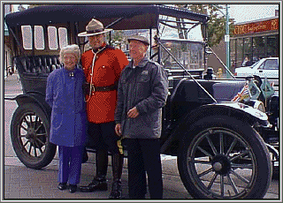
At Merritt, a parade was formed up and waiting for the Reo to arrive. Members of the Royal Canadian Legion, the Rocky Mountaineers Cadet Corp, a pipe band, and the Royal Canadian Mounted Police led the Reo along a three block route to the historic Coldwater Hotel. At the hotel greetings were exchanged and photos taken. In 1912, the original pathfiner Reo was also photographed in front of the old hotel. Inside, at a special luncheon, the Findlays and John Nicol were greeted by Mayor Clara Norgaard, M.L.A. Harry Lali, and members of the Merritt Historical Society. As well, greetings from M.P. Jim Hart were delivered by Mr. Richard Toevs.
Merritt is located at the meeting of the Nicola and the Coldwater Rivers. Early settlers to the area were attracted by its grasslands which were well suited for cattle farming. Today ranching is still important to Merritt, as well as mining and tourism. Merritt is centrally located along the Coquihalla highway (hwy 5) with easy access to Vancouver to the south, Kamloops to the north, and Kelowna to the east.
After leaving Merritt, the Reo headed north along the Nicola River. The road wound over and around the mountains as it followed the river below. As the route neared Spences Bridge the landscape became more barren and rugged as the Reo approached the Cariboo region of B.C. Sagebrush and cactus are common on the dry hills overlooking the Thompson.
At Spences Bridge the Nicola River flows into the Thompson River and highway 5a meets highway 1, the Trans-Canada. The Reo headed north along the trans-Canada following the Thompson River a short distance to the small town of Ashcroft.
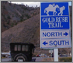
Ashcroft was settled in the 1860's as a farming area and to serve as a shipping point for goods being sent to the Cariboo goldfields. In the 1800's Ashcroft was an important transportation centre. When the C.P.R. came through in the 1880s, Ashcroft was the most northern stop in the B.C. interior. Freight being sent up to the Cariboo could be shipped by rail to Ashcroft, then by wagon to the interior. The Barnard Express (BX) stage coaches had an office in Ashcroft and transported goods and passengers up along "The Gold Rush Trail" in those days.
In later years Ashcroft was a major vegetable farming area, producing potatoes and tomatoes. Much of the farming was done by a large Chinese population. Today the vegetable farms are gone and Ashcroft is once again a ranching area. The trains pass frequently on both sides of the river, reminders of the role that transportation has played in Ashcroft's past.


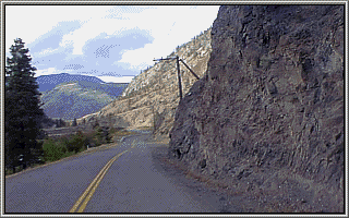
The road through the Nicola Valley winds through steep cliffs.


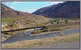
Highway 1 follows the Cariboo Gold Rush Trail along the Thompson River.
![]() ... Members of the 950 Rocky Mountain Rangers Cadet Corp led the Reo into Merritt
and stopped at the historic Coldwater Hotel
... Members of the 950 Rocky Mountain Rangers Cadet Corp led the Reo into Merritt
and stopped at the historic Coldwater Hotel
On this day in 1912 ...